With L and M away, I can do some things I’ve been wanting to do, but without having to consult anyone’s convenience but my own, and one of those things has been going out to do some back-road driving. I’ve been dipping into a book called Back Roads of Texas by Earl Thollander, and in one of the back-road drives he mentions a town in Texas that shares my last name. Of course, I knew long before then the town existed, but I decided I’d like to try going there and seeing what there is to see. So this afternoon after I finished at the Land of Færie, I ran by the house and picked up my copy of Back Roads of Texas, and started off.
I knew the hamlet of W— was over somewhere in Kendall County, but the map in Thollander’s book was too much of a closeup to be a lot of help. I could see from the frontispiece map that it was north and west of Boerne, but I didn’t want to go to Boerne to start, since that would have meant a bunch of interstate highway driving, and interstates were what I wanted to avoid. After peering at the maps in the book for a bit, I decided I needed to go on and buy a state road map, ’cos there was a big chunk of unknown country once I got west of Blanco, which the book maps did show that I had to do.
I stopped at a convenience store and got a map, but it didn’t help much. It didn’t show the place I wanted to go, or any roads where Thollander said there were roads. Fortunately, the book’s maps made mention of a couple of communities that were on the road map, so I decided to try going to the nearest community that was on the map and winging it from there.
That much decided, I went out US 290 through Oak Hill and Dripping Springs, and cut off on FM 165 at a wide-spot-in-the-road named Henly, which I knew would take me to Blanco and cut off some mileage too, since I used to go that way to church-group retreats.
FM 165 is definitely a rural road, with little shoulder and narrow lanes. The best thing it has is one place where cars come over a notch cut through a ridge, and the land opens out to give a gorgeous vista of the Blanco River Valley, thirty miles or more.
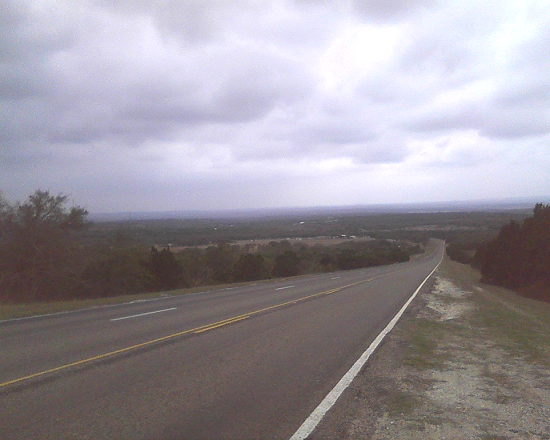
The view from the ridgetop. The only camera I had with me was in my cell phone, so you’ll have to put up with indifferent cell-phone picture quality.
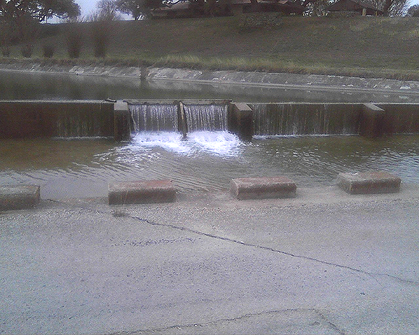
Down closer to Blanco, the highway runs more or less parallel to the Blanco River, a pretty, shallow, limestone-bedded stream. Just before I got to town, a modern bridge passed over the original highway, which was a low-water crossing of the old kind. I ducked down onto the old highway for a minute, to get a picture of a low dam just beside the road.
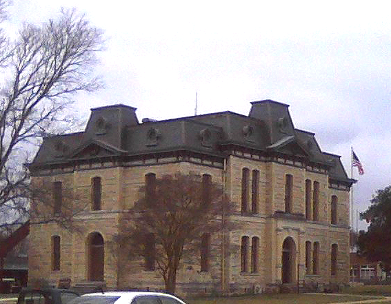
165 drops a traveler at the south edge of Blanco, but I thought I’d like to see the courthouse square, which I haven’t seen in twenty years or more, I suppose. Although Blanco has a courthouse, it isn’t the county seat; it lost that title in 1890 when a slim majority of the county voted to move the seat to Johnson City. The old Blanco courthouse now serves as the chamber of commerce and focus of a pretty, if a little tourist-y, square.
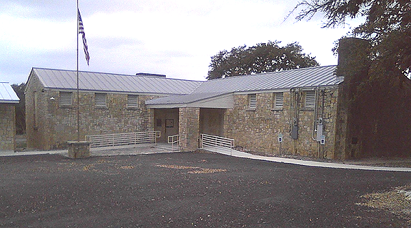
From Blanco, I ran south on US 281 (the American Legion Highway) eight or nine miles and got onto FM 473 to Kendalia and Sisterdale. 473 suffered from tired, worn paving and was much wigglier than 165 had been. At Kendalia, I found a pretty little limestone building which advertised itself as the public library but which, when I drove up to it, proved to be a WPA-era schoolhouse, re-opened and converted into a library. (I’d like to stop in one day when they’re open to see the building; it has three chimneys that all look to be functional.)
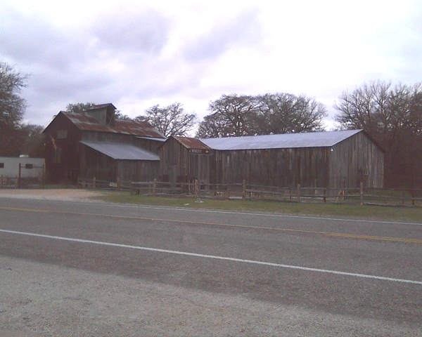
At Sisterdale I found a cotton gin dating to 1885 that has been converted into a winery. I didn’t stop to try the wine, but I’m gonna go back another day and do so.
I missed the turn at the north end of Sisterdale where 473 starts going west again, but quickly realized what happened, turned around and got back onto 473, and three miles later saw a sign saying “W—” in highway-department-sized letters and pointing left down what turned out to be a county road, which explained why it wasn’t on the big road map; they don’t bother with showing roads not maintained by the state. However, by this point I was so close that I just followed my nose into town.
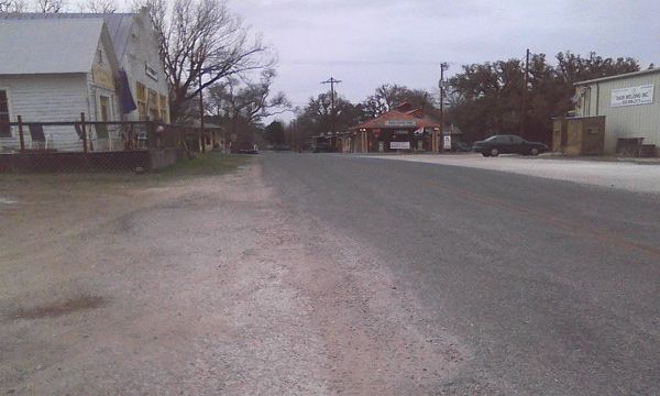
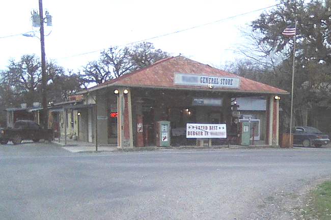
Well, if you can call it a town. There was a country-store-cum-burger-joint, an ex-gas-station-burger-joint-and-nightclub, a decommissioned post office, a new prefab post office, an upscale artsy-craftsy gallery, a tired commmercial building that looks like it used to be a hardware-implement place, and a scattering of houses. It was late enough by now that I really wanted something to eat, so I parked at the post office and walked crosstown to the “general store” that was really the burger joint and nightclub, and which had a sign out front bragging “Voted best burger in W—” (probably not a hard title to win, since it’s a two-horse race). There was a twenty-some guy hoking it up a bit behind the counter, his friend who was having a beer, and that was it. I ordered and got a cheeseburger and fries, which wouldn’t have been bad if the guy at the grill hadn’t doused everything in salt. He told me the general store was run by a caterer down the road, and gave me a pitch for “steak nite” which they have every Wednesday from six to nine, with live music. I might try it out one day if I can get that salt shaker out of his hand.

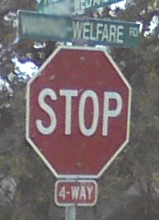
While I ate, I talked to the counter guy’s friend, who turned out to have a degree in environmental management from Texas State, and some enlightened views about overpopulation and climate change. Once I finished my burger, I realized it was late enough that even with daylight saving to help, I’d better start back if I planned to get home in the daylight. Instead of going back the way I came, I decided to go on round by Boerne to get to Blanco and thence home. But on the way, I had to go through the even tinier community of Welfare, too small even for a post office. So now I can tell people I’ve gone from W— to Welfare.

3 Responses to Texas back-road adventuring