Go west, young man:  2013 vacation, Day 14

Friday morning we slept in; it was after ten by the time we stirred, and we were dressed and ready to go out just about in time for lunch.  Which turned out to be Schlotzsky’s in Canyon, because Schlotzsky’s (yay Austin!), and it was near the museum we were going to for the afternoon.  When we sat down I noticed that the wall near us had an enormous picture of their original location down on South Congress Avenue, at which I had actually bought Schlotzsky’s sandwiches many years back.  There’s no longer a Schlotzsky’s there; now it’s an Amy’s Ice Cream location.  (Somebody ought to put up a blue plaque or something.)

Another thing that turned out to be Same as It Ever Was was the band camp.  There were several groups of high school students in the restaurant wearing lanyards identifying them as attending the West Texas A&M Band Camp, which I attended back in 1973 and ’74.  (This is how come I know anything about Canyon at all.)  The camp is one of the older ones in Texas, dating to 1952, and is now much tougher to get into than when I went—current-day students have to audition for admission.  In my time, you paid your money and you went, and auditions happened on the first day, when they sorted you into which band (there were ten) you were to be a part of.

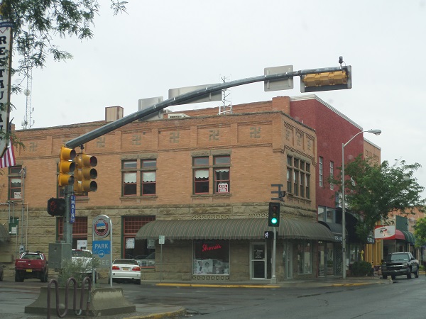
After lunch we drove back up all two blocks to the museum, which was on a street that I immediately recognized.  The commercial storefronts were exactly the same as in the Seventies, although the businesses in them had changed over the years.  The museum had changed some, mostly by adding on two new wings in the 1980s, but fortunately the passion for change hadn’t gotten as far as changing the Art Deco façade.
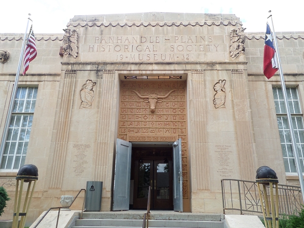
Panhandle-Plains Museum front entrance

Having the additional wings meant the museum could afford to clear out the entrance hall, and leave room to stand back and admire a series of murals depicting incidents in the history of the Panhandle.  It also gave space to set up teaser exhibits for the museum’s main collections:  natural history of the Plains, the cattle industry, and the oil industry.
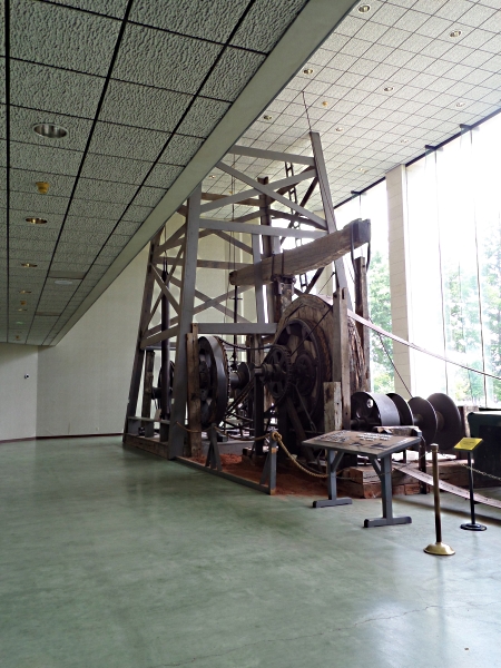
Drilling rig with oilfield tools

This isn’t to say that there weren’t other big spaces.  In the first added wing, put up in 1983, there was a complete oil derrick and its machinery, minus the top three-quarters of the tower, which just was not going to fit into the building.
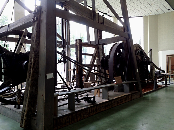
Drilling rig with oilfield tools

Another hall was devoted to one of the devices that made Plains life possible:  the windmill.  Their collection isn’t nearly as broad as the windmill museum in Lubbock, but they still had some impressive examples, such as this monster Eclipse mill with a twenty-two foot diameter wheel, used to pump lots of deep water to refill railroad water tanks.  This was another exhibit where the ceilings were just too low to allow a full display, but even the bottom half of the wheel is pretty damn impressive.
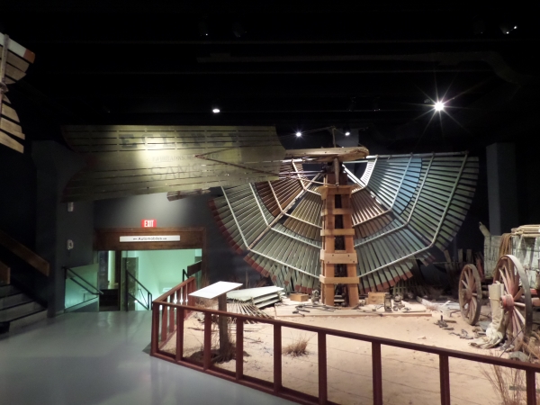
Eclipse windmill

The exhibit had one mill installed on a partial tower, with a sign inviting visitors to “spin it if you’re tall enough!”  L and M were entertained to find that I was tall enough to spin the wheel if I stretched.
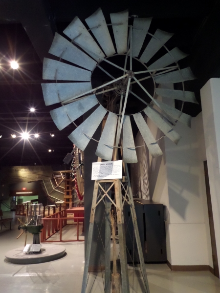
Dandy windmill – try it!

The oil industry exhibits continued throughout the first and second floors.  In the entry hall, they had this beautifully restored and rare “dial” gas pump, made by Southwest Pump Company of Bonham, Texas.
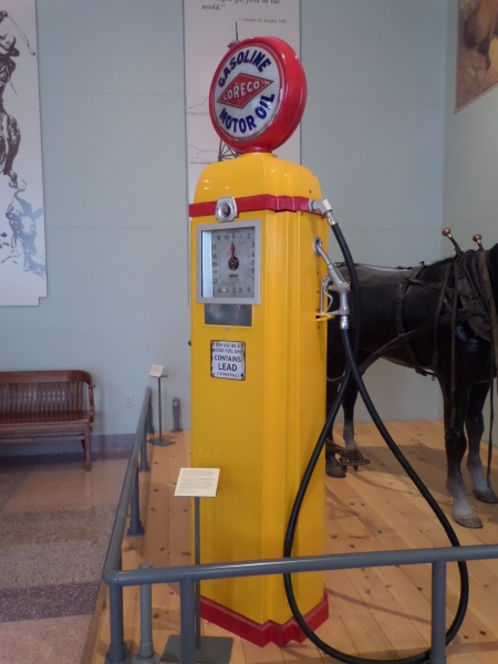
Southwest dial gas pump

Elsewhere, they had a mocked-up service station of the 1920s, stocked with all the junk that collects at a gas station.
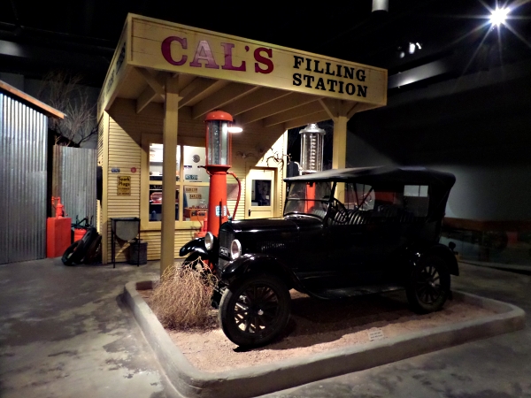
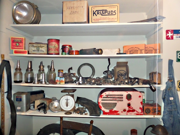
1920s service station

Service station shelves

Toward the back, the museum had built a mock “Pioneer Town,” with representative storefronts and contents of a small town in the 1890s.  I was especially taken with the bank cashier’s cage, which came from the Panhandle City Bank, now long vanished.  Note the frying-pan logo below the cage window, marked with B for “Bank.”
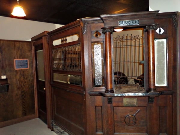
Panhandle City Bank cashier cage

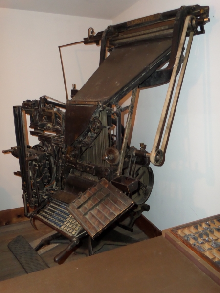
I was less taken by the newspaper/print shop, which had a clanging anachronism in it.

Washington hand press

Mergenthaler linotype

I can just about swallow the Washington hand press; it’s right for a frontier printing operation.  What I can’t swallow is the Linotype sitting in the same room with it.  Otto Mergenthaler didn’t invent the Linotype until 1884, and the likelihood that one of them would have gotten that far out onto the frontier ten years later is somewhere around nil.  The museum would have done far better to trade it to someone for a platen job press, which would have been out on the frontier that early.

So seeing all these things, and a lot of others, used up the afternoon for us, and pretty quickly it was time to drive out to the Palo Duro canyon to see the outdoor musical show Texas.  Driving directions were easy:  go out Fourth Avenue and keep going for ten miles or so.  The show is held at a site in Palo Duro Canyon State Park, and the surroundings are pretty impressive.  The Palo Duro was cut by the Prairie Dog Fork of the Red River, and is the second largest canyon in the United States, behind Grand Canyon.
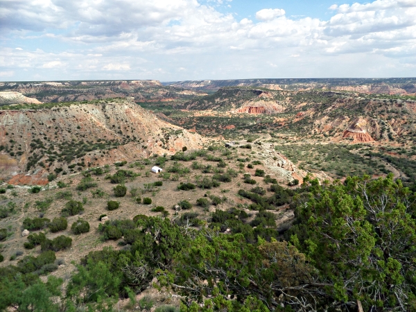
Palo Duro canyon

That’s the view from the park’s visitor center, just before you start driving down to the bottom to get to the theater.  It’s a snaky ride, full of hairpin turns and dropoffs.  L, who pays attention to such things, collected a new steep grade sign:  ten percent for a mile.  Previously her record had been an eight percent grade in West Virginia.
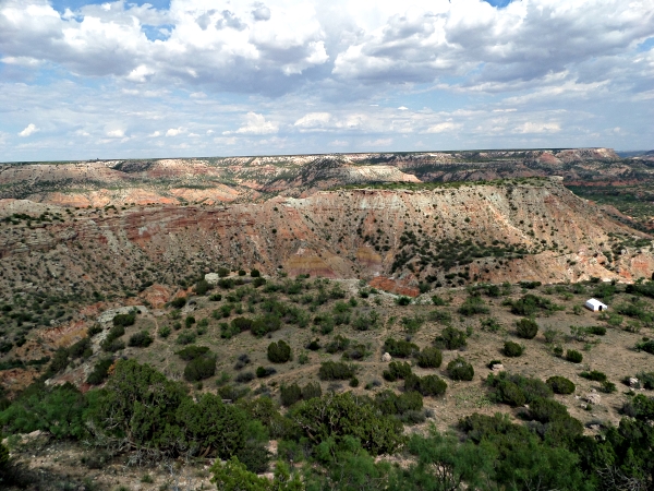
Palo Duro canyon

We got down safely, found parking, and went on in.  L had the forethought to buy barbecue suppers at the theater for us before the performance, which neatly solved the problem of when and what to eat.  The barbecue was really good—it may have been the best thing about the evening.  We were serenaded, I guess you would have to call it, while we ate by a band made up of cast members who were no better than fair.
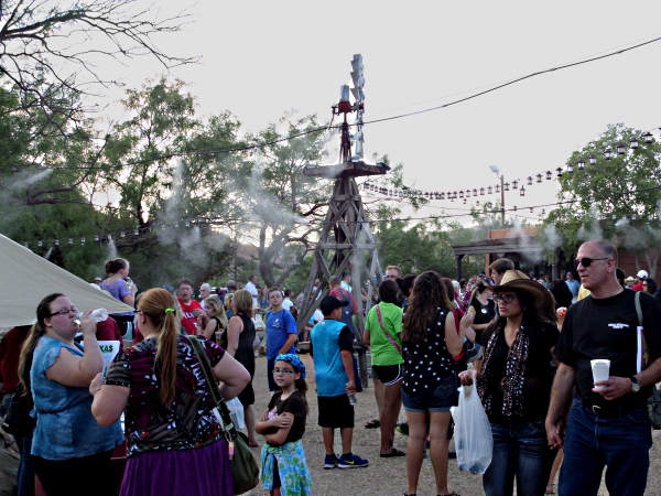
The crowd

A sampling of the audience before the show.  The things you see that look like smoke are water misters, which helped to keep the temperature in the waiting area bearable.

The show’s plot was ultra-predictable, not a lot more complicated than a high-school Winning of the West pageant with some local flavor thrown in.  Most of the cast was young and … not green, exactly, but not polished.  They had a flavor of earnestness, which I suppose you have to have if you’re going to serve up something like this and not retch.

At this point I need to say that while L and M had never seen this piece before, I had.  The production has been going every summer since 1965, and I saw it in seasons eight and nine.  We’re now on season forty-eight.  When I saw it in the ’70s, the rah-rah and flag-waving was confined to waving the Texas flag.  No more.

We got to the point where I remembered the show ending, with the coming of the railroad and the founding of a new town, and the Farmer marrying the Ranch Tycoon’s niece and everyone generally burying the hatchet (and not Quanah Parker’s hatchet, either; he got dragged into this thing by the scruff of his neck).  It didn’t end.  Instead, we got ten minutes more of unadulterated nativist, Know-Nothing jingoist rah-rah, all wrapped in the American flag (they had plenty to choose from; I think there were six being carried round the stage) and fireworks and a Bellagio-manqué fountain display that they’d had to cook up a couple of years back when wildfire danger was too great to use fireworks, and liked so much they kept it when the fire danger slacked off.  All they lacked was Uncle Sam and an eagle.  It was the worst kind of pandering to the worst parts of patriotism, and the audience loved it.  I was appalled.

As soon as the lights went up, I jammed on my hat and stalked out before I threw something.  (I couldn’t find where I had stashed the bag of rotten eggs and tomatoes, anyway.)  I had to stand at the back of the theater and steam until L and M could manage to get through the crowd, several minutes later.  We finally did get outside, L shushing me every time I rumbled for fear of a Vesuvian event.  Then we had to sit for most of half an hour until we could get a place in line on the road out.  It’s been a long time since I was that disgusted by a performance, but that bunch succeeded in the biggest kind of way.  I don’t think that even the museum, interesting as it was, could possibly make me want to go back.

But we finally got out of the canyon, hopped onto I-27 back to Amarillo and our hotel.  Saturday was going to be our last day out, and we were ready to get home.

Posted in Travel | Tagged , , , , , | 3 Comments

Go west, young man:  2013 vacation, Day 13

Thursday was another day of Endless Driving.  Starting point:  Durango, Colorado.  Ending point:  Amarillo, Texas.  Goal:  Get there, before dark.

FAIL.

Since L had decided not to challenge the high passes after being scared pantsless Wednesday, we backtracked south down US 550 to Farmington, New Mexico, where we missed the turn-off and wasted twenty minutes wading through endless sprawled-out suburbia.  In the downtown we did see one pre-1930 building decorated with pre-Nazi swastikas.

Building with swastika decorations

We abandoned 550 and took up with US 64 to get us across northern New Mexico.  It did, but not without incident.  At Dulce, center of the Jicarilla Apache reservation, I noticed the right rear tire looked really low.  Not only was it low, it had been that way for long enough to wear the tire bald, and we did not need to be going across sparsely-populated regions with bald tires.  Fortunately, the “Apache Travel Center” where we had stopped had a full garage attached, and they had a new tire the right size.  $100 and a half hour later, we were ready to go again.

We reached Chama just about in time for lunch, and in time for me to look at more trains.  Chama is the southern terminus for the Cumbres & Toltec Scenic Railroad, with equipment that simply didn’t survive elsewhere.

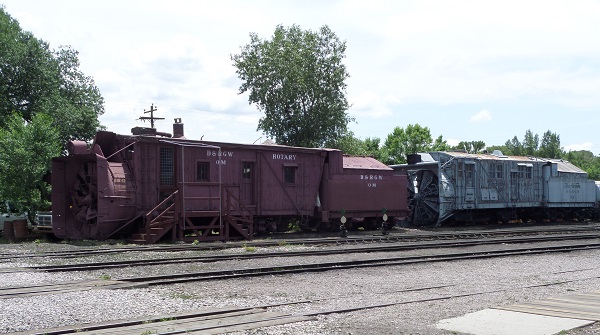
Rotary snow plows

The most spectacular pieces were two of the four rotary snow plows that once belonged to the Rio Grande.  OM, the one in front, is the oldest of the lot, built in 1889.  Behind it was plow OY, built in 1925 and the youngest.

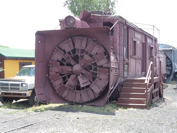
Rotary snow plow blade

The rotating cutter blade on OM.  It’s more than nine feet tall.  When it went out, it took two engines to push it and several cars of supplies to keep it running.  The last time either plow was under steam was in the 1990s, when OY was used for line clearance up to Antonito, Colorado.

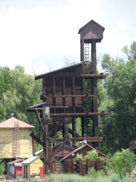
Coaling tower and water tank

The Chama yard is also notable for retaining its coaling tower and water tank.  These were generally torn down with the coming of dieselization.

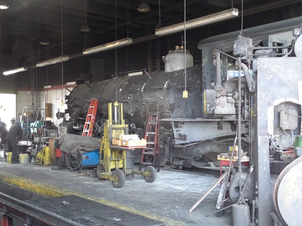
Locomotive being overhauled

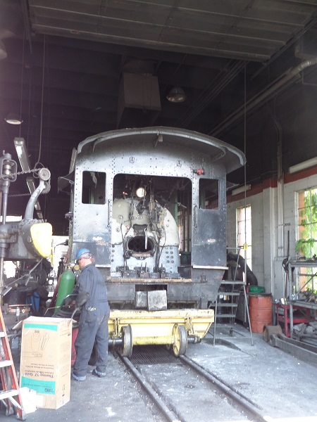
Boiler backhead

The shops at Chama only have two stalls, and one of them was occupied with a loco undergoing an overhaul.  I think it was engine 497, whose tender I later discovered off at the other end of the yard.  In the second photo you can see that almost all the instruments and controls have been taken off the backhead, except for the main boiler pressure gauge.  While I was taking pictures, the man in the photo started to climb down from the footplate, missed his footing and tumbled to the ground almost at my feet!

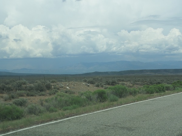
Dramatik Cloud is Dramatik

I spent more time wandering around the yard than I should, which put us behind after lunch.  Fortunately, there was nobody on the highway, just Dramatic Clouds that built up but held off raining until we got to Taos.

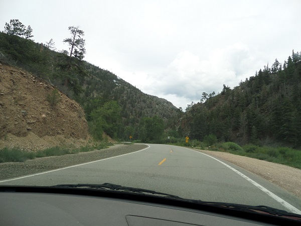
Road through Taos Canyon

Taos started more miles of whiplashing mountain road and canyons, making a big circle around south of town toward Angel Fire to avoid the Taos Pueblo reservation.  Speed limits dropped to as little as 25 in places.  To complicate things, the Dramatic Clouds started to dump rain on us.  We also had to play tag with a garbage truck that was out picking up dumpsters from park campgrounds.  L was driving, and I was fuming at how much farther our crawling pace was putting us behind time.  I estimated we wouldn’t get to Amarillo much before midnight.

And after one additional round of frustration, caused by a road paving project that had traffic cut to a single one-way lane with flagmen, we got free of the mess at Cimarron, best known as the nearest town to the Philmont Boy Scout ranch.

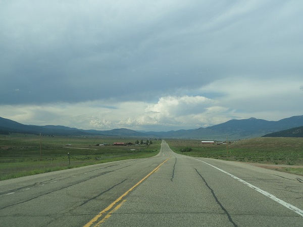
US 64 in northeastern New Mexico

And the road stayed empty, which was good.  I convinced L not to follow 64 up to Ratón pass, which was miles out of the way to the north, and instead cut across a state highway and got on US 56 to Clayton, which is the last place in New Mexico before you get to Somewhere Else.  “Somewhere else” in this case was Boise City, Oklahoma; M managed to persuade L to drive into the Oklahoma panhandle before we turned south, so she could say she had been in Oklahoma.

I had taken over driving at Clayton when we stopped for supper, and I was hooking it over the highway and steaming over all the delays the day had brought.  We did make the detour into Oklahoma, and because it was almost full dark we started noticing lots of strobe lights flashing, on both sides of the highway.  We knew that there couldn’t be any airports out there to explain as many strobes as we were seeing, and they were too close to the ground to be antenna aviation lights.  Finally L worked out that the lights were on irrigation pipes in cultivated fields, and we later learned that the strobes were to make it easier for farmers who irrigate at night to see whether the irrigation was running properly.  If the light stops flashing, he knows something is wrong and goes to see about it.

At last we turned south toward Texas on US 287 at Boise City.  (We had to make two circuits of the square before we got straightened out and pointed right, due to confusing signage.)  287 turned out to be one of those truckers’ highways, full of semis going from I-40 up to Denver.  However, most of them were oncoming traffic and the highway divided after a while, which made it a little easier.

We raced along through all those sparsely populated “thirty-mile” Panhandle counties.  At Stratford in Sherman County we went past a huge cattle slaughterhouse, and L remarked that she could smell blood from it even inside the car.  All of these towns, county seat or not, could barely muster two thousand people, and that’s small.

But even Highway 287 had to end, and we came to Amarillo at 12:15, just about as I had predicted.  Fortunately we didn’t have to hunt around to find our motel; it was right at the first exit off I-40.  We got checked in and fell into bed.

Posted in Travel | Tagged , , , , , , , | 2 Comments

Go west, young man:  2013 vacation, Day 12

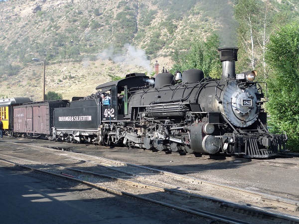
Wednesday morning we got up early but not too, with a 9:30 train to meet and that.  Boarding started at 9:00, but we stood around for a while so I could take pictures of the train before ours, waiting at the station.

Engine 482 at the station

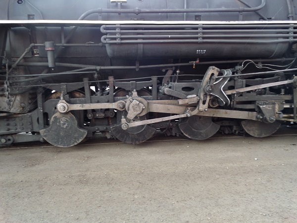
Engine running gear and drive wheel counterweights

To fit onto a three-foot track, the locomotive driving wheels are inside the frame.  The counterweights go on the outside; they’re intended to balance the rocking action of the drive rods.  They are ridiculously massive, and indicate the amount of force being applied to pull the loco and the train.

8:30 train leaving the station

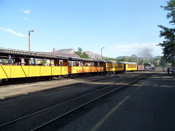
We had intermediate seating, not parlor car, but day car (at right) and definitely better than the ones riding the open-air bench seats in the gondolas at left.

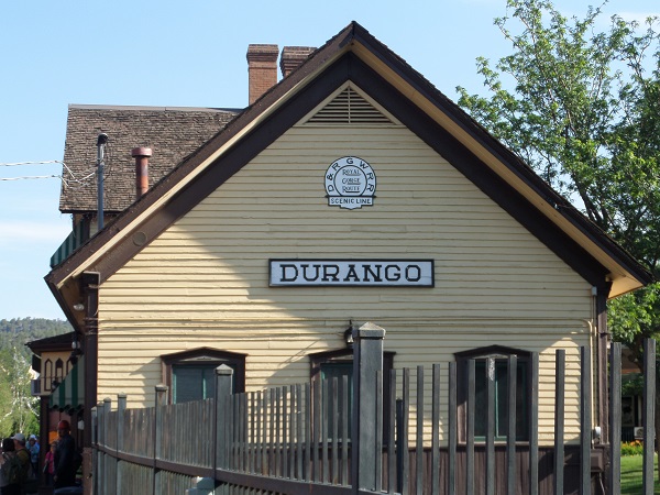
Durango station with D&RGW logo

The D&SNG has done a pretty thorough job of getting rid of the old D&RGW name and logo, but you can still find the original logo in a couple of places—the ends of the Durango station, and the end panels of the boxcars.  Still, they do use D&SNG instead of D&S to remind people of the earlier road.

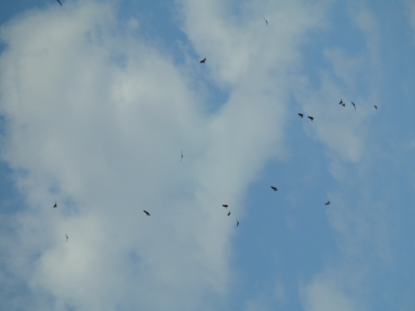
Buzzards circling

We saw a flock of buzzards circling over something dead up the ridge, the first ones we had seen since we left Texas a week and a half ago.

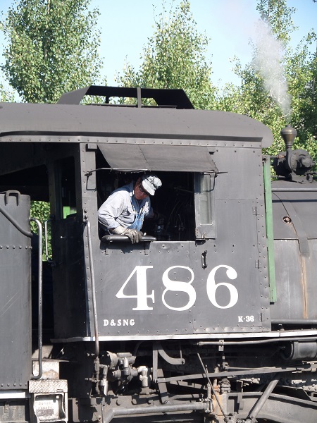
Backing up to hook to the train

Backing up the engine to hook it to the rest of the train.  The engineer sits on the right-hand side of the cab, a left-over from the beginnings of British locomotion, when everything traveled in a left-hand traffic pattern.

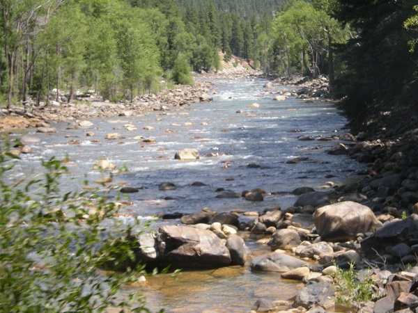
We left pretty much to time, and once out of town got up to our traveling speed, a grand fifteen miles an hour, guaranteed to get us to Silverton in time for a late lunch.  The track ran as close to the Ánimas river as it could get (it actually crosses the river five times in 45 miles), to take advantage of the low ground and avoiding the need to climb grades.

Bent rail pushed into the river by an avalanche

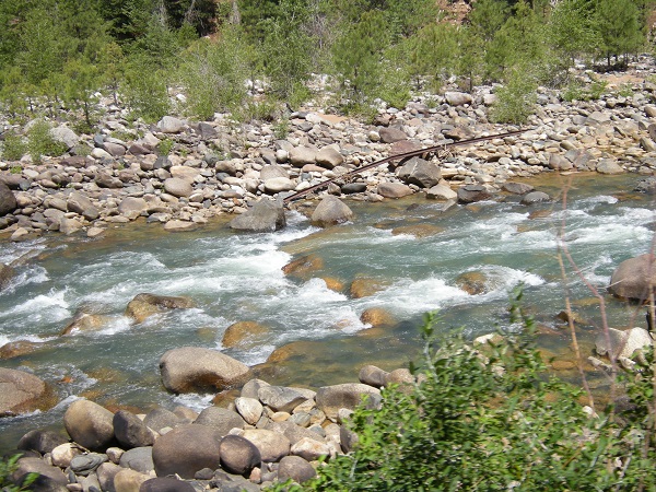
Often we were running right along the river bank, and at intervals would see old rails in the bed of the river, put there by floods or avalanches.  The current track uses rail weighing eighty-five pounds to the yard; the old rails in the river were fifty and sixty pound rail.  (Heavy-use main line rail can go up to 130 pounds per yard.)

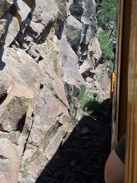
Cliff wall a couple of feet from the window

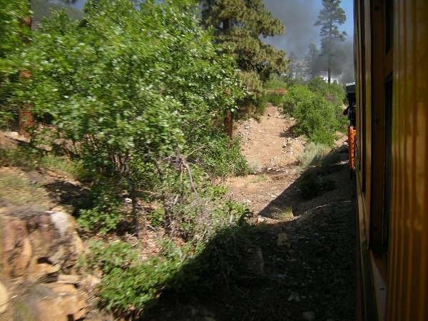
Foliage a few feet from the tracks

The line provided a great example of why three-foot gauge track was used in the mountains:  space.  It takes a lot less dynamite and a lot less fill to build a three-foot gauge line than it does to build a standard line of four feet, eight and a half inches.  The line wound through places where you could reach out and touch the sheer granite walls or foliage as they went past—not that this was encouraged, for fear of people losing phones, cameras, fingers or hands.  There were “KEEP HANDS INSIDE THE CAR” signs all over.

Rounding a curve

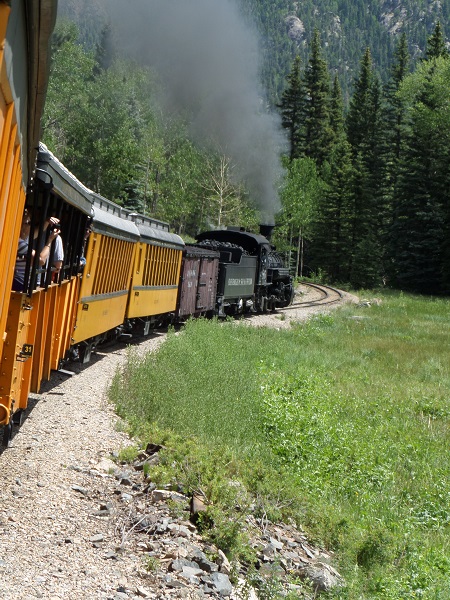
As we wound along, I could sometimes catch glimpses of the head end of the train rounding a curve.  No, you’re not drunk—the curve really is banked like that, and the cars are tilting.  There was a lot of that.

Colorado conifer forest

The forest around Durango is a mixture of fir, blue spruce, aspen, and piñon, with the occasional juniper thrown in for variety.  Little springs and creeks ran everywhere, an amazing sight after living so long in our own drought-stricken country.  At that, Colorado isn’t doing well either.  A Forest Service employee riding on the train as a docent told us that the river was running at only twenty percent of normal, and he hadn’t seen it so low in many years.

Rocks in the Ánimas River

This is a bit of the less steep-like-whoa gorge.  All those rocks you see sticking out of the river?  They’re supposed to be under several feet of water.  Snowmelt came early this year.  By this point the snow that ought to be feeding the rivers has been gone downstream for months.

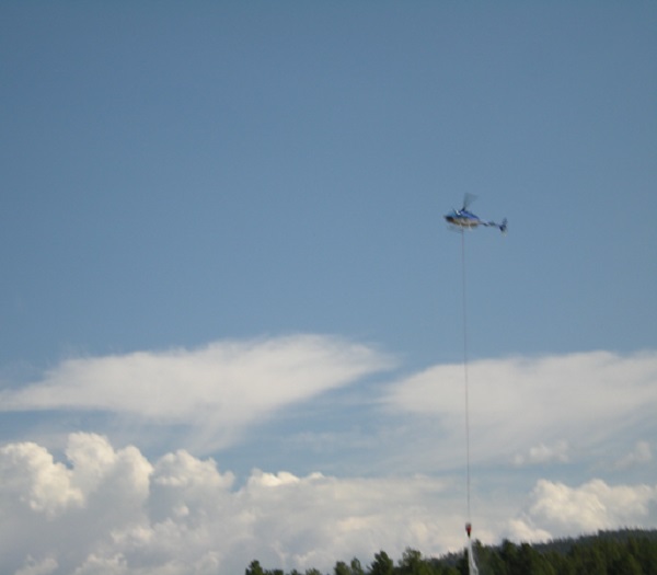
Fire-fighting helicopter

We had to stop at one point to let firefighters work on a small fire near the tracks.  There was a helicopter hovering over us at a couple of places, letting down a bucket on a long line to dip water out of the river and go drop it onto the fire.  It was a “bucket” only for certain values of the word; it held 150 gallons.  Each train carries a boxcar with it as the first car behind the tender; the car holds fire fighting equipment for the railroad employees’ use, in case a flying ember from the smokestack set a fire, despite the spark-arrester bonnets on the stack of each engine.

As we rolled along, the engineer periodically sounded the whistle.  Sometimes it was obvious why:  a crossing, or a whistle sign by trackside.  Other times, though, there was no obvious reason to do it, and I decided that sometimes he just let off the whistle for the noise of it, and the echo.

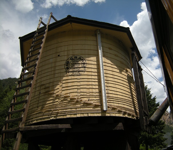
Water tank at Needleton

At the ghost town of Needleton, we stopped to take on water.  Not from this tank, unfortunately—despite its spruced-up appearance, it’s been out of service since the 1960s.  Water actually comes from a decommissioned tank car set at trackside.

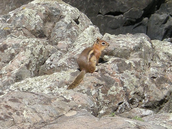
Golden-mantled ground squirrel

At another point, a golden-mantled ground squirrel (which we first mis-identified as a chipmunk) posed for M’s camera.

Mine workings

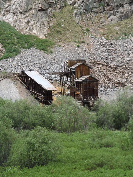
So this went on for more than three hours.  Finally we started to approach Silverton, and saw the remains of abandoned mine workings like this.  We learned later that although commercial mining ended some years ago, there are privately owned mines that are still being worked by their owners.  If you have $15 for a Colorado mining permit and work on the mine for at least three weeks per year (or spend $2,000 on improvements) you can mine more or less indefinitely.

And we got to Silverton, just in time for (1) lunch and (2) a rainstorm.  Fortunately, the worst of the rain held off until we were inside Natalia’s 1912 Restaurant, operated in a former bordello (well, a lot of surviving buildings in Silverton were bordellos at one time or another).  After lunch we had a few minutes before our bus back to Durango was due to leave, so we dropped in at the blacksmith’s, who turned out not to have any actual smithing going on.  Instead, he had a bunch of art-metal pieces for sale.

The bus left for Durango at 3:00, the same time as the return train, but we got back at 4:30, while the train took until six.  Our driver was a school teacher from Aztec working a summer job, who proved to be a good tour guide and kept us partly distracted from the OMFG STEEP AND WINDING road which was OMFG STEEP AND WINDING.  Even L admitted to being unnerved enough to decide that she was not going to try driving over the 10,000 foot Wolf Creek pass to get back to Texas.  (Instead, we went back through northern New Mexico, avoiding all the high passes.)  The bus driver also explained the lack of highway guard rails:  rails hinder the snow plows from pushing snow off the road and down the hill, which is the only place available to push it, so no guard rails.

On the way into town L noticed a restaurant called SERIOUS TEXAS BAR-B-Q which sounded like a good idea because we’ve been gone from Texas for two weeks and there IS no barbecue in California worth mentioning and BARBECUE!  So we went, and it was good.  They served the meat on butcher paper like the best places do, and they had all the right sides (pinto beans, potato salad, coleslaw, white bread), and the brisket was just fatty enough and cooked to tenderness, and they serve Meyer’s Elgin sausage and OMG REAL BARBECUE.  In Colorado.  L took off a couple of points for no beef ribs, but no beef ribs is her perennial complaint about BBQ joints, even those at home.
And after that we went back to the motel, full of good barbecue and all, and I wrote up the blog entry for days ten and eleven, and finally went to sleep to get ready to go to Amarillo by morning Thursday.

Posted in Travel | Tagged , , , | 2 Comments

Go west, young man:  2013 vacation, Days 10 and 11

Monday morning we started for home, the long way around.  This time we went out I-80 across the Bay Bridge for Oakland and Sack o’ Tomatoes.  Driving on the interstate felt novel, given how many non-interstate highways we’d driven over on this trip.

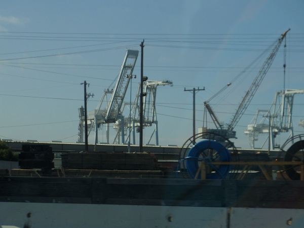
Container loading cranes at the Port of Oakland

Cranes for unloading container ships at the Port of Oakland.  This is what they use to load up all the incredible long trains of containers that we saw going east as we drove west.

At Sacramento, we got off I-80 and onto US Highway 50, where we saw a highway mileage sign telling us it was 3,073 miles to Ocean City, Maryland.  You know, just in case we were going there.  But since we weren’t, we went toward Carson City.

After Sacramento, we drove.  We drove and drove and drove, and then we drove some more.  And then for a change, we drove.  We got to Carson City in time for a really late lunch.

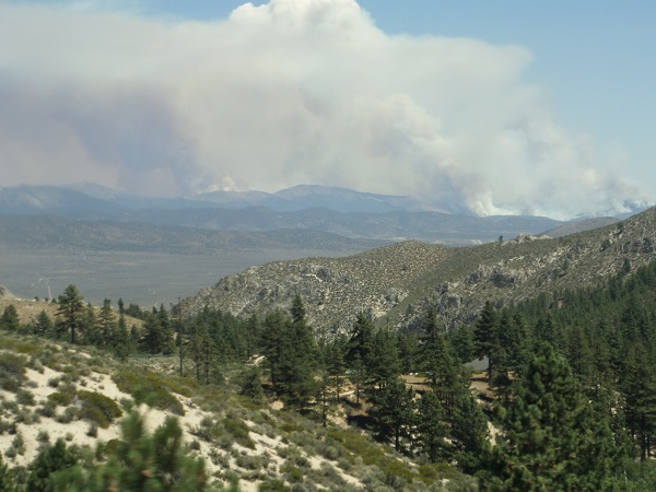
Forest fires south of Carson City

As we came in from the west, we saw at least three forest fires burning south of town, their plumes rising up and joining into a gigantic cloud in the stratosphere.  We asked at the restaurant whether we were likely to run into any fires going east, but they said they didn’t think we would, and we didn’t.

Western Nevada desert

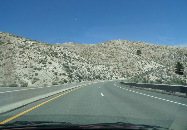
Nevada desert is some of the most desolate country in the world, outside of maybe the Sahara.  Even tumbleweeds have to struggle to grow here, and there’s practically nowhere a tumbleweed can’t grow.  As you can see, there’s the occasional juniper that manages to hang on, but they’re so rare I think the few inhabitants give them names.  “Look, Ma, there’s little Eddie done grown half an inch since five years ago.” “You’re right, Pa, pretty soon he’ll be so big we won’t know him.”

Life magazine once called US 50 through Nevada and western Utah “the loneliest road in America,” and with reason.  Spots the mapmakers deemed worth marking come about every fifty miles, and “worth marking” appears to mean “two buildings and a parking lot.”  The road is also known as the Lincoln Highway, as it follows the route of the first real transcontinental highway through the state.

One thing US 50 has is a lot of mountains.  Between Fallon and the Utah state line we climbed over seven summits or passes over six thousand feet, one of them almost eight thousand.  We knew this would be the case, so L drove so I could quietly panic without having to drive at the same time.  There were also very few guardrails, like almost none, although we didn’t find out why this was until we got to Colorado.
The only three places beyond Fallon that I thought deserved the name of settlement were Austin, Eureka, and Ely.  Austin was maybe a dozen buildings, and several impressive collections of automotive and farming junk.

Eureka opera house

Eureka at least had a proper main street, and some buildings that hinted at more prosperous days as a silver mining community.  Beyond that it was more hills and more highways run along the side of precipitous grades, all the way to Ely, where we stopped for the night as being about halfway to Durango.

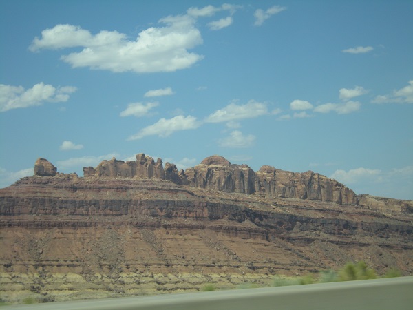
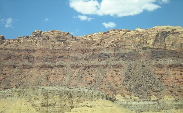
Friday we got into Utah, and the spectacular painted deserts.  (Another thing US 50 has a lot of is straight lines.  On one reach leading into Hinckley, Utah, L drove 22 miles by the mile markers without having to turn the steering wheel.)  We abandoned 50, and its fellow traveler I-70, after Green River, and turned south down US 191 toward southern Colorado.  There was still lots and lots of empty land available, but now we occasionally got tourist towns like Moab, which is a favorite of white-water rafters.

Utah mesa country

Utah mesa country

There were tons of dramatic mesas and cathedral formations.

Uplift formation

There were also places where the rocks were not just being worn away; they show new rock being born, like this uplift.

Salt basin

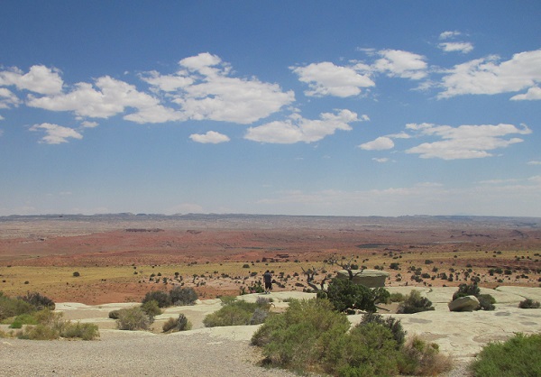
And then there was the sheer emptiness, like this salt flat somewhere in the Uinta Basin, thirty miles or so of red dirt and salt pans.

Window formation

And there were window formations, like this one north of Teec Nos Pos.

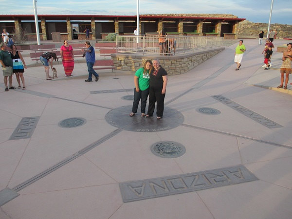
Tuesday M decided she wanted to go see Four Corners, so we changed our route and instead of turning east at Monticello, Utah to go to Cortez, we continued south to Blanding and then down into the very top of Arizona to meet US 160 and Teec Nos Pos, then swooped back northeast and reached Four Corners monument ten minutes before closing time, just long enough to take a picture and go again.  M didn’t want to be in the picture, but L told her that Daddy had driven a hundred miles out of the way and broken a number of speed limits to get her there in time, and she could damn well come and be in the picture, so she was.

M and L at Four Corners

We got out a few minutes after eight and started up toward Durango.  At Cortez, about forty miles away, I pointed out that we better get something to eat soon because all the restaurants in little towns like to close up early, and if we didn’t get something soon we might not get anything at all.  M seconded this and L, sensing mutiny, agreed to stop and eat in Cortez.  While we were eating, it got dark outside so L had to do the whole stretch from Cortez to Durango in the dark and with not very many road reflectors to guide her.  What with no reflectors and no idea what the shoulders (if any) might look like, she took it all at about 45, which meant traffic built up behind her waiting for passing lanes.  We only got honked at once, but several people did rather blast by us.

We got into Durango around ten-thirty, managed to find the hotel, and fell into bed except for me; I stayed up, wrote a day’s entry, and read LiveJournal, Dreamwidth and RSS feed until midnight.

Posted in Travel | Tagged , , , , | 2 Comments

Go west, young man:  2013 vacation, Day 9

Sunday morning L wanted to sleep in, and M had been agitating to find a bookstore to replenish her reading material.  I got online and started searching for bookstores in San Francisco that might be open on Sunday.  There was one bookstore near the hotel, but it didn’t keep Sunday hours.  I finally found Christopher’s Books over on Potrero Hill which claimed to open on Sunday; we got directions on how to get there by bus from the concierge (amazing fact:  there are NO chain bookstores in San Francisco; they all either failed or moved out, leaving the field to the indies).  A couple of blocks’ walk brought us to the 10 bus stop at Second and Mission.  A twenty-minute ride put us at 17th and Connecticut, and a couple of blocks’ more walking brought us to the bookstore at 18th and Missouri.

It was closed.

This was actually OK; we were early.  It was only 9:45 and the shop wasn’t supposed to open until ten.  We went back down the block, found a bench, and sat and watched the Sunday morning life of a San Francisco residential neighborhood away from the tourist influences.  It looked like an area I would like to go back to.  Across the street from our bench there was a French bakery, a Mediterranean joint, an Asian fish place, and a goat-cheese pizza place; on our side there was a little Mexican hole-in-the-wall.  People walked dogs, got coffee and pastries, and generally acted like Sunday morning.  It was peaceful.

Corner of 18th and Connecticut

House fronts

House fronts on Missouri.  The shapes say that there are some serious oldsters underneath the remodels.

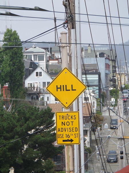
Steep hill warning sign

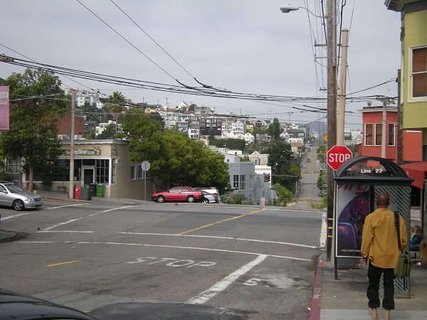
This was the only non-peaceful thing:  a sign warning trucks of a steep hill and that it was probably better to go another way.

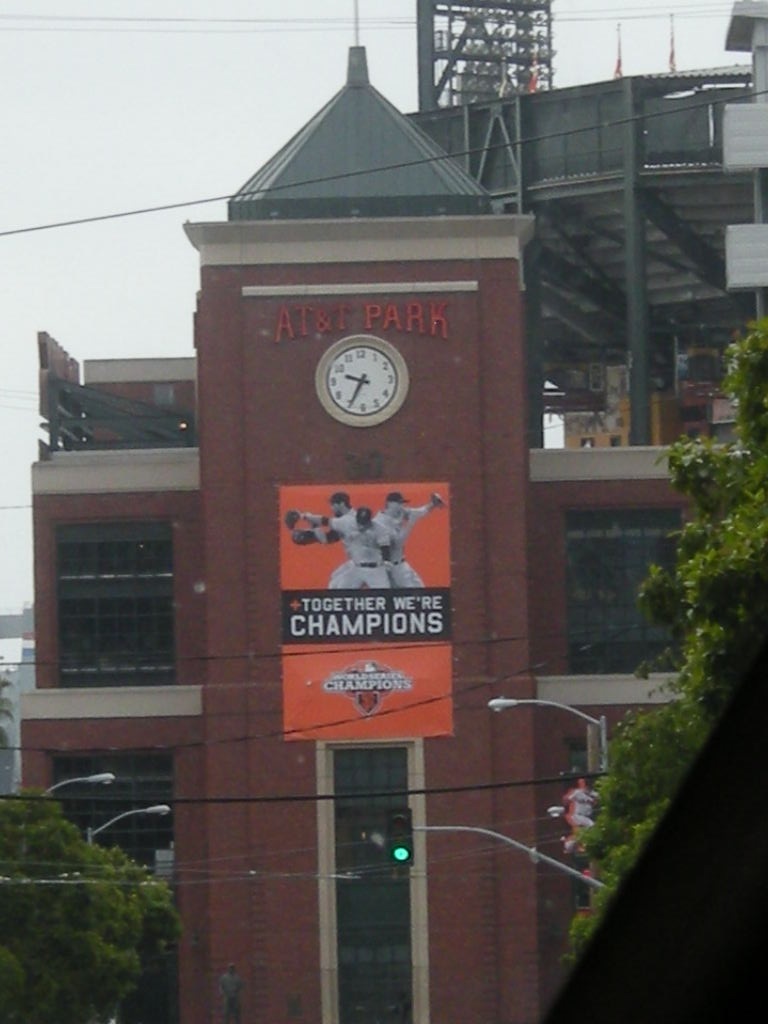
The shop opened a few minutes after ten and we were the first customers, although several more followed only a few minutes later.  M found the book she had been after and one other, and I found a John Green title I hadn’t read.  I chatted books for a few minutes with the clerk at the register, we paid for our purchases, and walked back down to the bus, which came along about fifteen minutes later.  The ride back was a mirror copy of the ride out, passing by the Adobe office on Townsend street, the Caltrain commuter depot, and close enough to AT&T Park for M to get a picture of it down the street.

AT&T Park, home of the Gi'nts

(Which reminds me of a joke:  Q:  What do you get if you cross an anthill with a nuclear reactor?  A:  Gi-ants.)

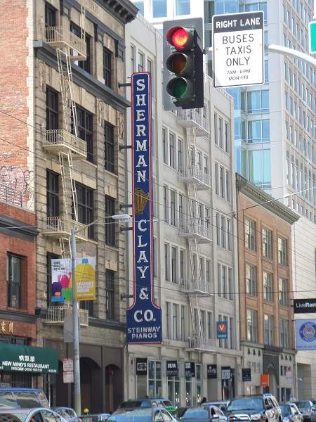
The bus decanted us at Second and Mission, and we walked the two blocks to the hotel, spotting this sign along the way:

Steinway piano dealership

Piano dealerships, handling only pianos, just aren’t common any more.  I remarked to M that that was something killed first by the radio, then by stereos and finally by iPods.
On the way back to the hotel, I noticed the Contemporary Jewish Museum was right there on Mission Street, and since I had been seeing advertisements all over downtown for an exhibition of photographs by Allen Ginsberg, I decided to do that in the afternoon.  I went over and spent an hour or so there, learning that Ginsberg was a rather interesting portrait photographer, with enough of a sense of history to write long captions for many of the photos describing who he was shooting, where, when, and what they were all doing at the time.  The museum didn’t allow photography, but click the link above to take you to the Ginsberg project site, with many of the same pictures.

By suppertime, M and I were pretty much agreed that we were tired of eating at the diner (Mel’s Drive-in) near the hotel, so we went to the food court at the Metreon Center instead.  And that was it for the night; we came back and crashed out to get ready to leave Monday morning for Colorado.

Posted in Travel | Tagged , , , , , , | 1 Comment

Go west, young man:  2013 vacation, Day 8

Saturday morning L and M danced a short while, then came and collected me for the club’s group photo.  All but one of the dancers was there; we later learned that the missing one was in the middle of negotiations to sell her house and couldn’t get away from the phone.

With that done, we got the car from the parking garage (Fifth & Mission garage, and a reasonable $32 per day) and started up the Coast Highway for Novato, to have lunch with L’s uncle Peter, whom she hadn’t seen in forty years.  Traffic was solid across the Golden Gate, which was also socked in.  A few miles later on we discovered that the traffic was all people going to Stinson Beach, and past that exit everything cleared up.  The MapQuest instructions proved accurate, and we found the house with little trouble.

Peter’s wife Hélène served us a nice summery brunch, then sat and listened as Peter drew us both out about Texas, and he and L talked family stuff.  (L thinks Hélène’s English may still be weaker than her French, for all that she’s lived in California for years.)  We visited until mid-afternoon, then came back to town.  Saturday evening was the banquet, after which L and M danced again until late, and I watched YouTube.

Posted in Travel | Tagged , | Comments Off on Go west, young man:  2013 vacation, Day 8

Go west, young man:  2013 vacation, Day 7

The convention began in earnest Friday morning, and L and M went down to the ballrooms and danced, while I stayed in the room and caught up on my blog feed and YouTube subscriptions.  They came back about ten-thirty and we got breakfast at Denny’s, or tried to anyway.  The staff were stretched beyond their limit, as a cook and a waitron hadn’t shown up for work.  We finally got out about 11:15, and decided to spend the rest of the day playing at tourists.

San Francisco has a really varied transit system.  Besides their fleet of buses and the cable cars everyone knows about, they have a fleet of electric trolley-buses and a number of vintage trolley cars, dating from the 1910s to the 1940s.  One of the vintage trolley lines runs down to Fisherman’s Wharf, our goal for the afternoon, so after a short misdirection when I got us on a car going up to the Castro by mistake, we got turned around and headed back down the F line.  The picture is a 1928-era Peter Witt model formerly used in Milan, Italy, headed back uptown on the F, taken from our car.

1928 Milan trolley

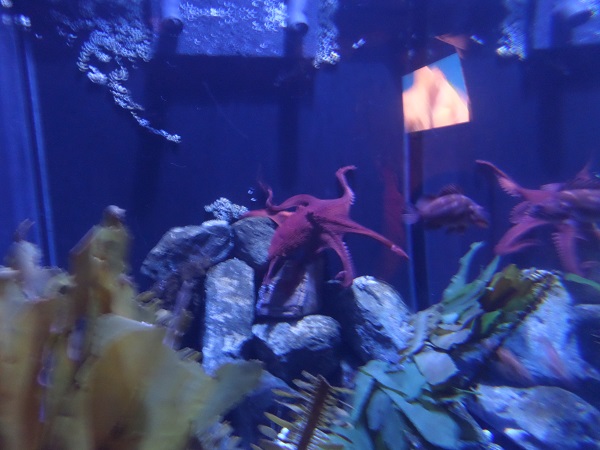
The trolley dropped us in front of the Aquarium of the Bay, which M wanted to see ’cos she likes aquariums.  I thought it a distinct disappointment after seeing Monterey, although they did have a couple of nice features, including a long tunnel through a tank stocked with Bay fish, from the common (anchovies) to the very uncommon (white sturgeon).  They also had a nicely visible octopus, which was pleasant as the Monterey octopus had been shy or otherwise octopied.

octopus

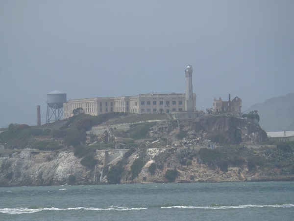
For a wonder, the Bay was fog-free and we had a good view of Alcatraz.  I didn’t feel any great pull to visit and M was uninterested as well, so we didn’t book a tour.

Alcatraz

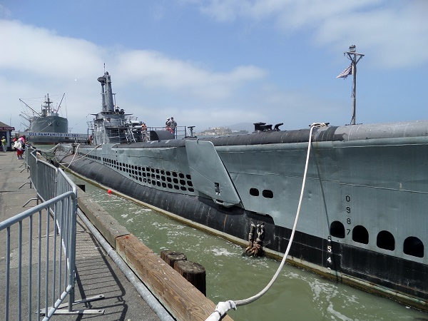
Pier 43 had one of L’s intended destinations for the afternoon:  the Jeremiah O’Brien, one of the last two surviving Liberty ships from World War II, as well as S.S. Pampanito, a Korea-era submarine.  M wangled L into touring the Pampanito (I get claustrophobic so I didn’t go on), but by the time they got back dockside L’s knee, which had been giving trouble all day, was bothering her so badly that she had to give up the idea of going on the O’Brien.

S.S. Pampanito; Jeremiah O'Brien in the background

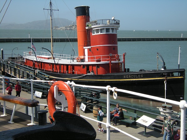
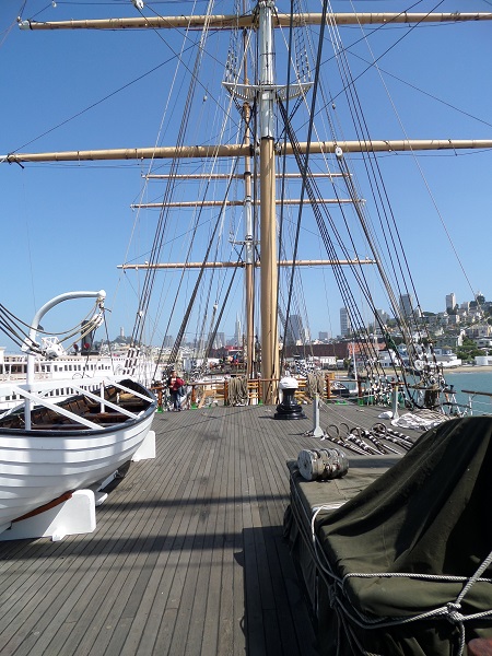
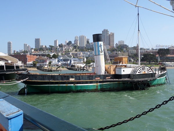
Instead, we walked on down to the national maritime park at the Hyde Street pier, where several older ships were moored:  the C. A. Thayer, a lumber schooner undergoing restoration, the Eppleton Hall, a coal tug from Newcastle in dreadful condition (I hope they’re raising money to try to restore her; her freeboard is rotted through in places and her paddles are completely rotted away, leaving just the iron frames), the Eureka, one of the sidewheel car ferries that used to take cars across the Bay in the days before the Golden Gate was built, the Hercules, an ocean-going tug used for ferrying log rafts, and the Balaclutha, a square-rigged three-master once used in the lumber trade.  Balaclutha and Hercules are both more or less seaworthy, Eureka’s side wheels have rotted completely away below the waterline, and the Thayer is completely dismasted as part of the restoration process.

Hercules at her mooring

Hercules at her mooring.  She’s a very trig little ship, well shined and polished.

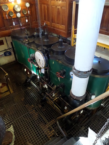
Hercules engine room

Hercules’s engine room and telegraph.  She used a triple-expansion steam engine.  The boilers were on the deck below and blocked off.

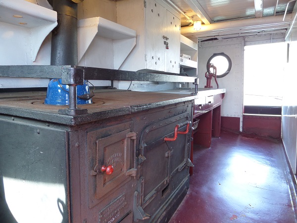
Hercules galley

The galley.  This is quite spacious as galleys go; I’ve seen ones barely big enough to hold the stove and the cook.

Balaclutha main deck

Balaclutha’s main deck, looking forward from the cabins.  She was completely square-rigged, unlike Elissa and other cargo ships I’ve had to do with.  L was surprised at how small the hatches were, given the ship was hauling logs.  (I suppose it might be explicable if she were hauling finished lumber.)

tug Eppleton Hall

The Eppleton Hall, rusting away.  She has a noticeable list to port, you can see the wooden decoration over the paddle guard delaminating and rotting off, and those with sharp eyes can see the fragment of a wooden paddle hanging on to the frame.  The display card said she steamed from Newcastle to San Francisco under her own power in 1970, but to all appearances she’s been allowed to rot at her mooring since then.

It was getting late in the afternoon and we were supposed to be back for the dancers’ grand march from Union Square to the hotel, so we walked up to the Hyde Street end of the cable car line, bought tickets, and proceeded to wait.  And WAIT and wait and wait, for two hours in the sun, as the line for the cars inched forward.  We did have a street guitarist serenading us with ’60s and ’70s singles, and at one point an escape artist entertained us by getting himself out of a straitjacket and chains.

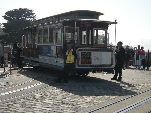
Every car that came in to the terminus had to be turned on the turntable by hand before it could be sent out again.

turning a cable car by hand

Finally our turn came for a car, and we got on and waited some more while the conductor took up tickets.  At last he couldn’t think of anything else to delay us with, so he rang his bell, the gripman let in the clutch on the cable, and we were off . . . for a couple of blocks.  Then we got stalled halfway up Hyde Street hill behind a couple of cars that wouldn’t get out of the way.  When they finally did go, the car was too heavy to start itself again with everyone on board, so the conductor made us all get off and walk up to the next flat place to wait for the car.  A good quarter of the people immediately leaped directly into the car’s path to take pictures, only moving sheepishly off after I roared at them, “FOOLS!!  Get off the tracks!  Are you just trying to get yourselves killed??”

Then it was crawling up and down hill across town, stuck in traffic and inching along.  We thus missed the grand march, and instead went to get supper after which L and M went and danced some more while I wrote up the entry for the third and then went to bed.

Posted in Travel | Tagged , , , , , | Comments Off on Go west, young man:  2013 vacation, Day 7

Go west, young man:  2013 vacation, Day 6

It may have been 115° in Las Vegas Tuesday, but Thursday morning in Monterey was a much more coastal and bearable 60.  L got us all moving fairly early, and we were at the doors of the Monterey Bay Aquarium before ten, giving us plenty of time to look at things, and we needed it.  The aquarium is huge as aquariums go, with tons of exhibits.  L remarked on the way the descriptions and displays had been made kid-friendly without dumbing them down to the point an adult would be bored.

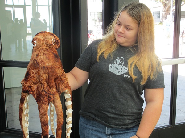
As soon as we got through admissions, we found a docent with a pet stuffed octopus, at which M was skeptical.

M and the octopots

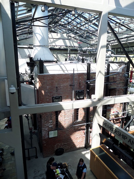
The aquarium inhabits a couple of old sardine canneries on Cannery Row, right on the shore of the bay.  Since telling the story of the canneries fitted in with the history of the bay, the renovation left in place several of the cannery boilers that had powered the plant’s sardine cookers.  One of them was marked with the name of the Agnews State Hospital and dated 1913, two years after the hospital reopened following its collapse during the 1906 earthquake and subsequent rebuilding.  Was the boiler made for the asylum and never used?  No source I can find has anything to say about it.

Hovden cannery boilers

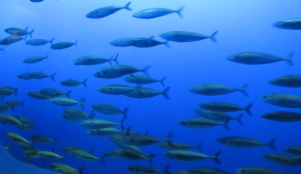
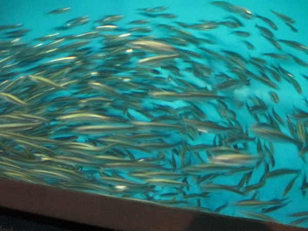
One of the many sections included, naturally, schools of sardines and anchovies, the fish that had fed the local economy for the first half of the twentieth century (the fish population collapsed at the end of World War II from radical over-fishing).  They swam in closely packed schools, like . . . well, like sardines, except when a passing shark in the tank caused the school’s normal mill to break and reshape itself like a lava-lamp blob out of the shark’s path.  The tank water was too murky for good shooting, so I couldn’t capture these amazing maneuvers.

School of sardines

School of anchovies

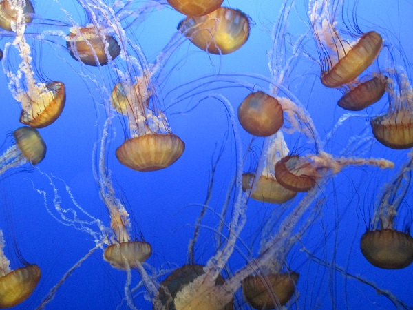
Other areas of the aquarium held equally fascinating displays of jellies and seahorses, who are often stranger than imagination. 

Sea nettles

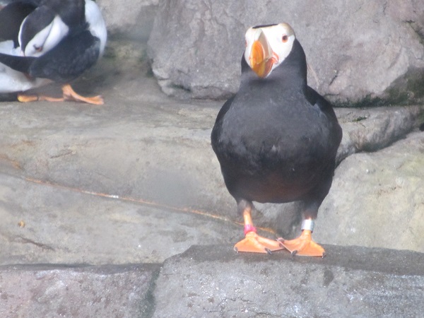
M, of course, just had to visit the penguins, penguin fiend that she is.  The informational card told us that much of the aquarium’s current collection had come to them from New Orleans, after Katrina ruined the aquarium there.  The enclosure also had a number of puffins, a bird that looks like a badly told joke.  The tufted puffins, which I didn’t get a good shot of, look even more preposterous than this.

common puffin

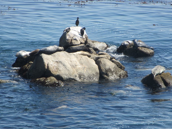
Outside, we could see half a dozen seals and some cormorants sharing a rock just off the observation deck.

Seal rock

One last thing to mention was a group of art objects made of trash collected from the ocean, mostly plastics, and meant to raise awareness of just how much old plastic goes into the oceans every day and what it does to marine life.  The most spectacular piece was one by an artist who re-created Hokusai’s The Great Wave off Kanagawa using only scraps of photo-degraded plastic.

Great Wave made from plastic trash

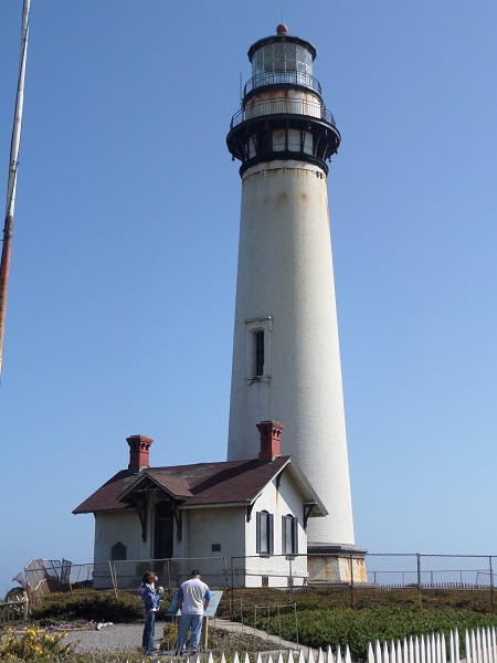
We ran down in the afternoon and needed to get on up to San Francisco anyway, so we had a late lunch at a brewpub further down Cannery Row, retrieved our car, and drove on up the Pacific Coast Highway toward the city.  As it was the Fourth, EVERYbody had come out to whatever sliver of beach they could find and the road was lined with parked cars.  North of Santa Cruz, I spotted a fingerlike structure against the sky, and as we got closer we found it was a lighthouse, the Pigeon Point Light Station.  Unfortunately, the tower is closed ever since a piece of the cornice fell off in 2001, but we did get out and walk around the grounds.

Pigeon Point light

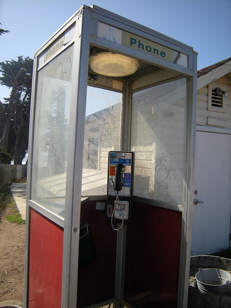
At the foot of the path, there was what must be one of the last remaining in-service phone booths in the universe, and I had a sudden insane desire to text its whereabouts to Clark Kent, just in case he needed one.

Phone booth

We got back in the car and started off again, winding through truck farms and vegetable stands and suburban communities until we finally got to Daly City, where we found that Malvina Reynolds’s complaint was still a valid one.

They’re all made out of ticky-tacky

I was fine driving in, until we hit the elevated part of I-280 and my vertigo flipped out again at being in the air.  I managed not to have a complete freakout before we got down to ground level again, and we got to the hotel (the San Francisco Marriott Marquis) with no more than the usual amount of frustration at the thousand little streets and alleys of SoMa, most of which seem to go any way but the one you want to go.

Posted in Travel | Tagged , , , , | 3 Comments

Go west, young man:  2013 vacation, Day 5

Wednesday morning we got up, braved the already-101°-at-9:00-AM heat, got breakfast and got the hell out of Las Vegas.  I was only too ready to see the back of the place.  L diagnosed my distaste for it as an intense dislike of wretched excess, which is after all what Vegas is built on after gambling, and an almost equally intense dislike of people trying too hard to Have Fun—which is an affliction almost endemic in the city.  The two, combined with a continual assault on the senses no matter where on the Strip you went, guaranteed a miserable Sam.

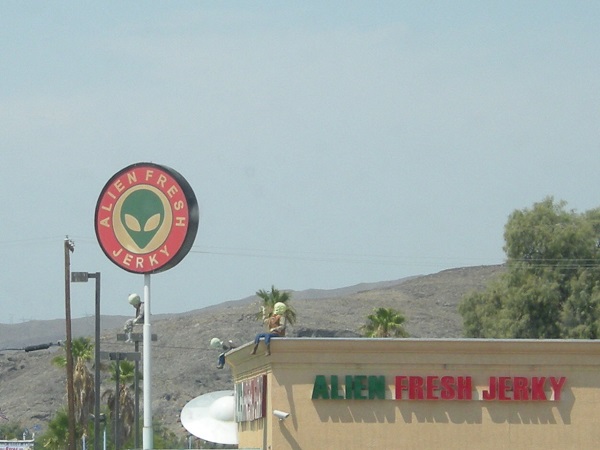
We stopped for gas in Baker, a wide spot in the road a few miles inside California, and home to the most piratically high price for gas we’ve paid the entire trip—$4.599 a gallon for regular!  While we were stopped, M saw this sign, but I wasn’t sure they were really using fresh aliens so we didn’t get any.

Alien Fresh Jerky store

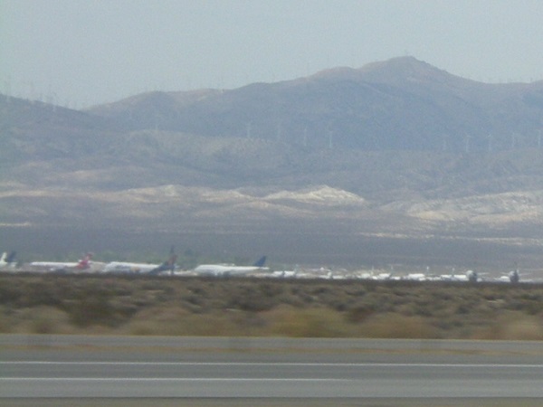
We ran southwest on I-15 to Barstow, then cut west and north on California 58, running along the north edge of Edwards Air Force Base, where the space shuttles used to land.  Just beyond it, outside of Mojave, we saw the Mojave aircraft boneyard, or at least what there was to see of it from several fields away.

Mojave, CA aircraft boneyard

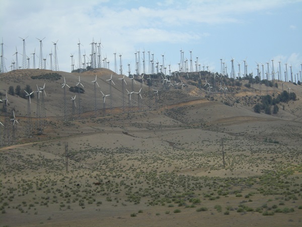
A few miles beyond that we passed through one of the most enormous wind farms I’ve ever seen.  There were several hundred mills of various types and sizes scattered across the top of a ridge of hills.  I don’t have any idea where the power they generated might have been going.  That’s a pretty desolate part of the state.

Wind farm near Mojave

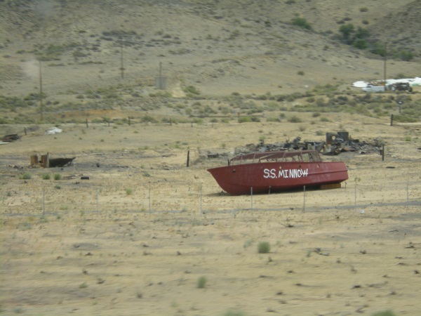
We also passed a relic of 1960s TV, now fallen on hard days.

S. S. Minnow hulk

A quick stop for lunch at Tehachapi and we were gone again, reaching Bakersfield by early afternoon.  At Bakersfield we saw the exit for Buck Owens Boulevard, but didn’t take time to stop.  Instead, we ran straight west on 58 through fields of greens and almond orchards until we finally got to a wide spot called Buttonwillow, where we found another oil patch with many different sizes of pump jacks and several Chevron oil processing facilities that went on for a long ways.

Past Buttonwillow the road got worse, a lot worse.  Up to now it had been two narrow lanes winding through wherever there was a low place.  Now it started to climb, and climb and climb, throwing continual switchbacks and loops without any thought of a guard rail.  There was just us, and the air, for several thousand feet worth of “up.”  L, who was driving, continually shifted between second and third gears, having to go all the way to low once or twice.  In the passenger seat, my vertigo was giving me the leaping willies from the views down into hundreds of feet of nearly vertical slopes.  It went on for miles like that; four or five at least before we crested the last ridge and started down again.

We later learned that we had climbed the Temblor Range, at the foot of the San Joaquin valley.  I hope I don’t have to go through a stretch that badly paved and routed ANYtime soon.  L said it was payback for a time that I scared her pantsless in 1984, driving on a bad stretch of US 221 in the days before the last sections of the Blue Ridge Parkway were complete.  You’ll have to imagine how steep it was for yourself.  I was far too unnerved to take any pictures.

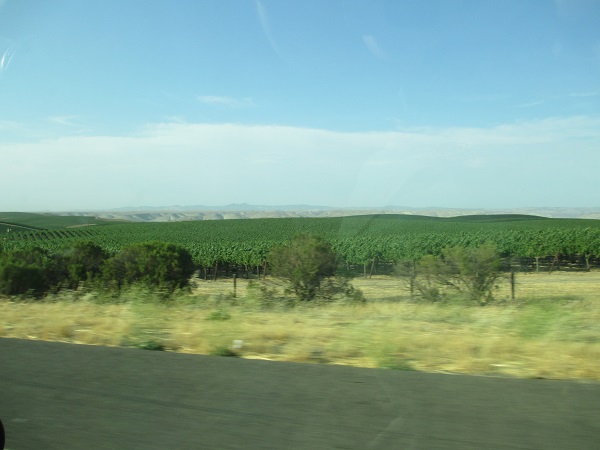
Over the hills, the road settled down to become a country highway that eventually turned us out on US 101 at Santa Margarita, in San Luis Obispo county.  We picked that up and ran northward for a couple of hours through the blessedly flat California and Salinas valleys, going to ground for the night in Seaside, a suburb of Monterey, so we would be ready to visit the Monterey Aquarium on the Fourth.

California Valley vineyards, San Luis Obispo county

Posted in Travel | Tagged , | 3 Comments

Go west, young man:  2013 vacation, Day 4

Wednesday morning, it was hot.  It was Nevada hot.  By the time we left the hotel at 10:00, the thermometer was already over 100°.  But we left the hotel anyhow, and set out for Hoover Dam, which we had passed coming in from Arizona the night before.  The highway has been improved a lot since L was here in 2003; it was four lanes all the way back to the dam, and travelers don’t have to drive across the top of the dam any more.  There’s a high bridge over the gorge below the dam.

High bridge at Hoover Dam

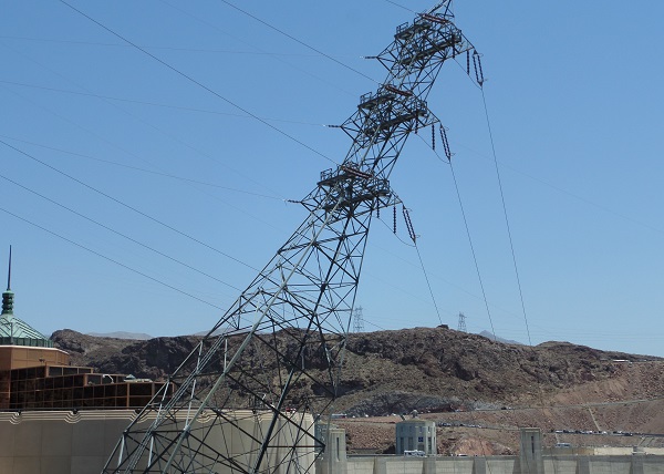
The first thing we were confronted with was an electric distribution tower that looked about to topple momentarily into the gorge below the dam.  It wasn’t, but it was bolted to the rock face at a vertiginous angle of forty, and made you feel the world was tipping sideways.

Electric distribution tower leaning into the gorge

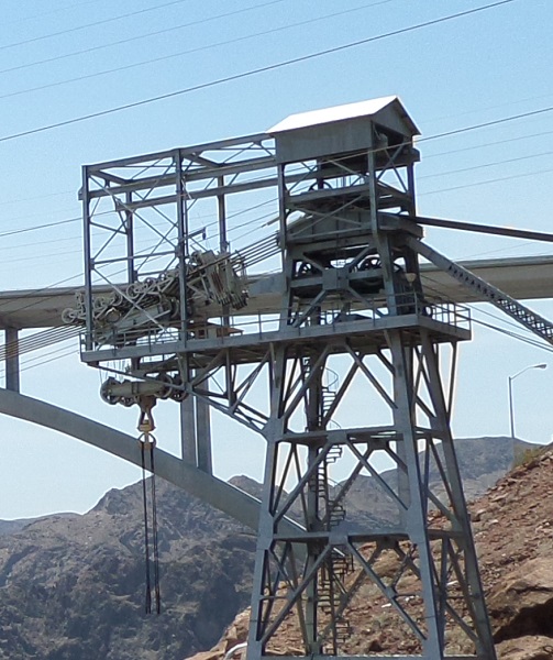
Several cable ways were strung for moving vats of concrete across to the work site.  After they were done, one of them was left intact to use for maintenance.  There are still great big things you have to swing out and down to the river.

Control house and cableway

We got into the parking garage, which was a struggle with Quinn because of all the steep ramps from one level to the next and the crawling cars, and trying not to roll back into the guy crowding up behind me as I let the clutch out.  We finally found a space on the fifth level, parked and went back down to get our tickets.

We had a momentary holdup at the DHS screening station, when the man wanted me to go put my pocket knife back in the car if I didn’t want it confiscated.  I was damned if I was going to hike back up all the stairs I had just come down over a knife, which wasn’t even a very good knife, so I told him he was welcome to it and I’d get another.  That sorted, he let us all through and we went on in to the visitors’ center, watched a video on the construction of the dam, then got herded into an elevator and lowered 500 feet into the center of the dam for a tour of the turbine rooms.

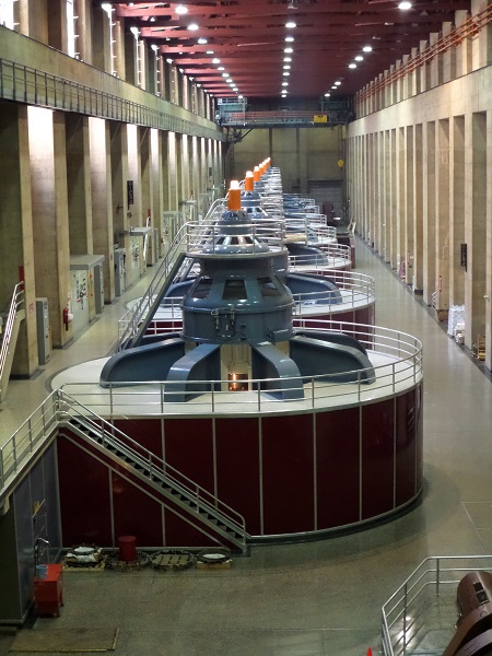
First we got a diagram and a lecture from the docent about the sheer size of everything in the dam.  He told us the room we were standing in was right on top of one of the thirty-foot intake pipes that fed the turbines, and the vibration we felt in the floor was a thirty-foot-wide column of water running through the intakes.  The turbines were also impressive.  We only saw one of the two rooms, the one on the Nevada side.  There’s another just like it on the Arizona side.  Each of the generators puts out twelve million watts of electricity, running at 178,000 horsepower.  “Our” turbine room had eight generators, while the Arizona one had nine.  The California metropolitan water district gets the largest fraction of generated power at 28.5%, and Los Angeles being the largest single customer with 15.4%.

Turbine generation room

After that we were taken back to the surface, where we went through an exhibit about the dam and could take pictures of the dam, the intake towers, and whatever else.  I felt the most sympathy with a quotation by a wife of one of the dam workers, who obviously hated the place; she said “We came from Illinois where everything was green; there were always enough old vegetables in the fields that you could get by.  Here there’s just nothing but brown and rocks.”

Tour done, we walked down and looked at the memorial to the men who died during the construction of the dam.  Surprisingly, there were relatively few.  Of the estimated 16,000 men who worked on the project during its lifetime, only 96 (some say 115) were killed by accidents.  This doesn’t, of course, count the many who died of “pneumonia” from working in the tunnels—“pneumonia” being what the company doctors were told to call the many cases of carbon monoxide poisoning from the fleets of trucks used in digging the tunnels.  Carbon monoxide poisoning was a compensable on-the-job injury; pneumonia wasn’t.

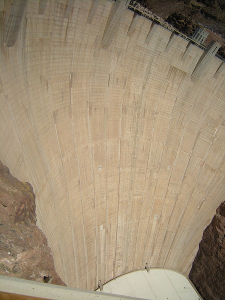
I tried taking pictures of the dam face, but as with everything else about the place, the sheer height of it all gave me vertigo so it didn’t come out well.  M did somewhat better with her camera.

Hoover Dam face

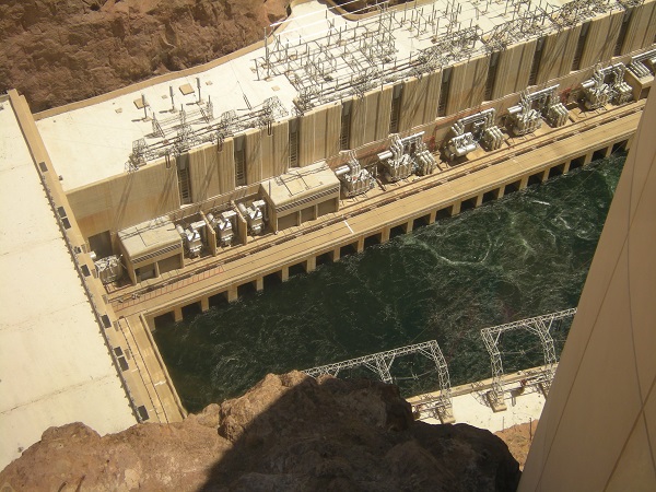
Outflow into the river from the turbines

And that was about all there was to see, so we turned around and drove back to Las Vegas, where L and M went to see Cirque de Soleil’s Mystère and I stayed in the room and read.

Posted in Travel | Tagged , | 2 Comments